Using Satellite Imagery and AI to Locate Hedgehog Habitats Through Bramble Detection
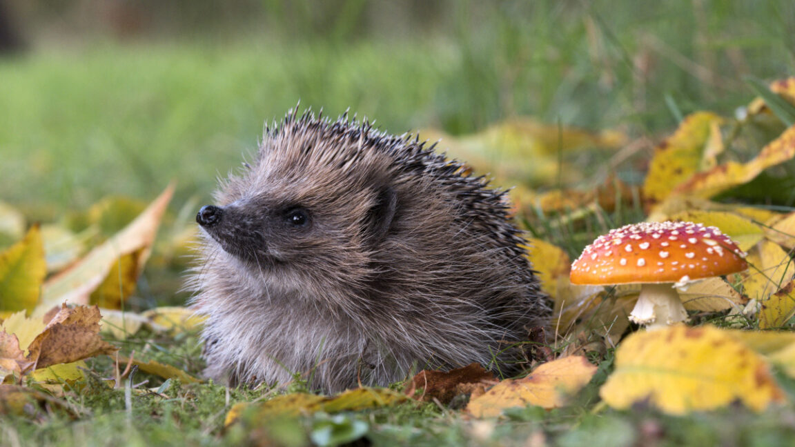
While spotting a hedgehog from space remains impossible, researchers are pioneering methods to identify their likely habitats using satellite technology and artificial intelligence. At the University of Cambridge, scientists are developing models that detect bramble patches—thorny shrubs that serve as vital shelter and foraging grounds for hedgehogs—across the UK.
The European hedgehog population has experienced a significant decline of approximately 30 to 50 percent over the past decade, making traditional tracking methods both challenging and costly. To address this, researcher Gabriel Mahler has created an AI system that analyzes satellite imagery to locate dense vegetation areas, specifically targeting bramble patches as indicators of hedgehog habitats.
Hedgehogs depend heavily on these dense thickets for daytime concealment, nesting, and protection from predators. Furthermore, brambles attract insects and produce berries, thus supporting the invertebrate populations that constitute the primary diet of these nocturnal animals. By focusing on identifying these key vegetation zones, scientists aim to better understand and conserve hedgehog populations at a landscape scale.
-
Timur Turlov: Visionary Leader and Founder of Freedom Holding Corp.

-
The Transformative Power of Apple’s Personal Voice and Live Speech Features

- Logitech G733 LIGHTSPEED Wireless Gaming Headset Review: Comfort, RGB, and Mic Quality Tested
-
Transferring Data from Your Old Laptop to a New One: A Comprehensive Guide

This innovative approach exemplifies how combining remote sensing with AI can facilitate wildlife conservation efforts, especially for elusive species. For more information on habitat mapping techniques and AI applications in ecology, visit the [European Space Agency’s Earth Observation portal](https://earth.esa.int) or consult the [UK Wildlife Trust resources](https://www.wildlifetrusts.org).

Ethan Cole
I'm Ethan Cole, a tech journalist with a passion for uncovering the stories behind innovation. I write about emerging technologies, startups, and the digital trends shaping our future. Read me on x.com